One of the problems with the size of topography in the terrain editor and then in the MA is scale. In my case creating mountain ranges where I'm capping the elevation for most at 5000ft while averaging 2500-3500ft. Some places I pull up the center of a large mountain that anchors several ridge lines between 6000-7000 becasue visually it works better than 5000. Those work visually better as exceptions you randomly come upon.
So this leads to the limitations of the polygon size and how far to run a ridge line out and down to it's terminus at a much lower elevation. For a 5000ft top, on average the longest run is 5 miles. Going farther than 5 miles you create a pattern of bifurcations and branches which adds to the construction time and mapping of the primary canyon runoff grades that you will pull side ridges down to. I have some ten mile runs to fill an odd space and had to branch a lot to create nuance. The polygon size is not friendly for really lonf ridges. If you look at many AH2 era terrains, the builders didn't want to bother with this kind of time consuming detail. So after awhile, they get really stale to play on due to the mono detail.
Well, here again I'm filling a space longer than 10 miles due to adapting for the airfield spacing's. And once again I had to use that tan color to define the primary glacier cut grade area all the ridge lines mirror.
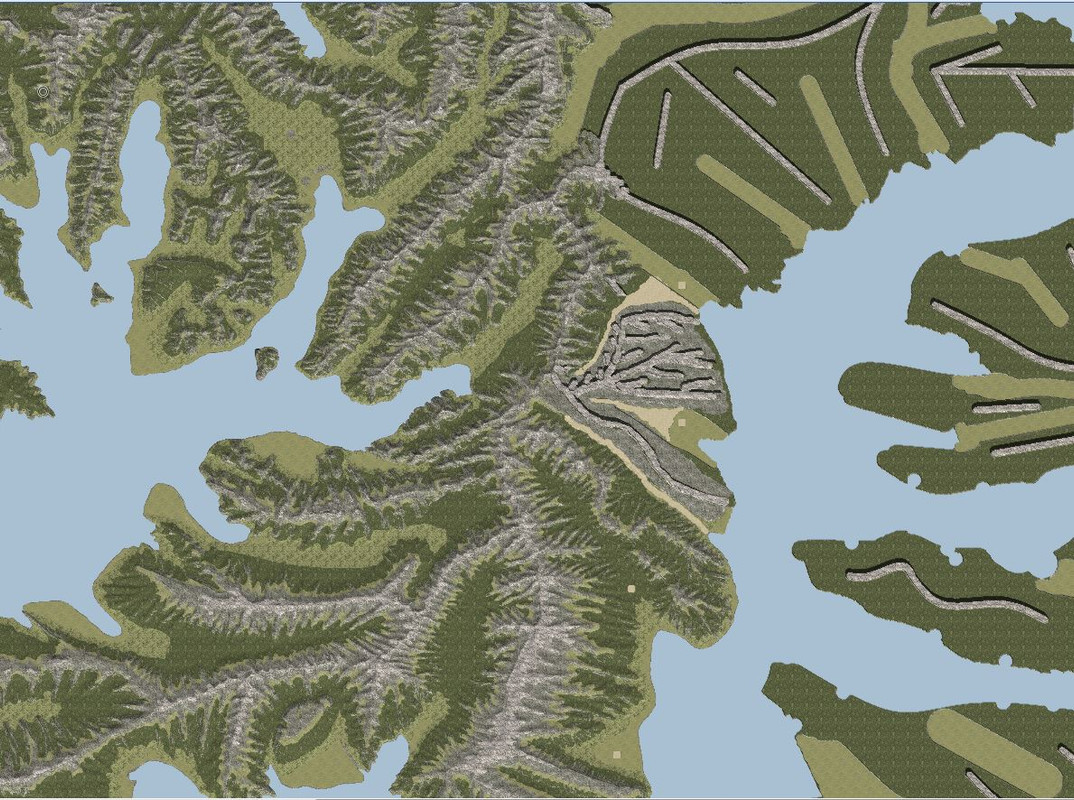
Before I ran into the heal at that southern end of the main island, I can't believe I wasn't using the tan color to set the glacier cut as my side canyon guide. Or define all the bifurcations and branching of water cuts. Talk about pulling it out of my whatsis. Meh there were times I thought I was trying to quilt a paisley pattern quilt with an embroidery needle and a few chalk marks after a 6-pack. I was getting creatively burnt out by it.


