Author Topic: Automatic terrain generation from geographical data (a tool I created)  (Read 23001 times)

Offline bustr

  • Plutonium Member
  • *******
  • Posts: 12436
Re: Automatic terrain generation from geographical data (a tool I created)
« Reply #120 on: April 22, 2019, 02:41:36 PM »
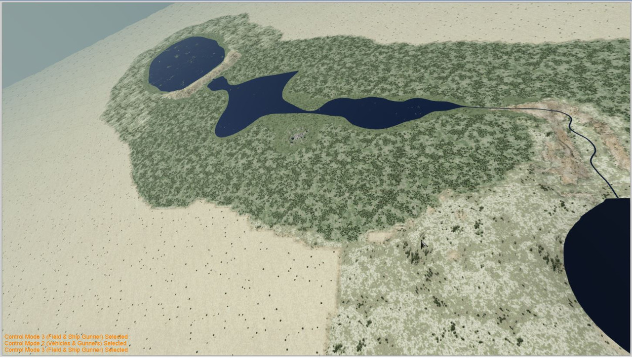
In your tutorial the section about lakes at altitude, if you don't need really complicated shoreline shapes, you can use the new river path object. Create many segments then stretch their individual widths. The bed for it to lay on has to have the shores(boarders) flat so you don't get intersection interference from the surrounding polygons.

Here I ran one river and created several lakes.


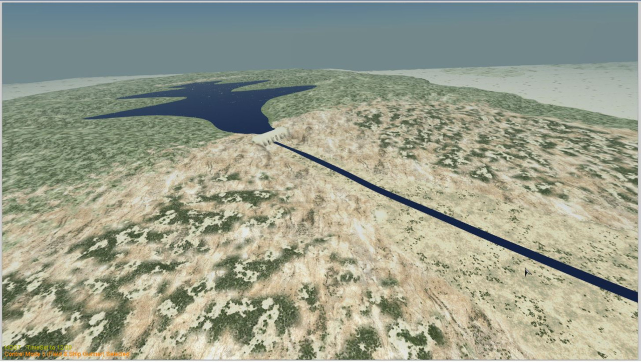
Wanted to bomb a dam with a Lancaster.


bustr - POTW 1st Wing


This is like the old joke that voters are harsher to their beer brewer if he has an outage, than their politicians after raising their taxes. Death and taxes are certain but, fun and sex is only now.

Offline artik

  • Silver Member
  • ****
  • Posts: 1906
      • Blog
Re: Automatic terrain generation from geographical data (a tool I created)
« Reply #121 on: April 23, 2019, 01:33:32 AM »
when I created this program the lakes hadn't been implemented in AH, so... I need to do some/many  changes to the program
Artik, 101 "Red" Squadron, Israel

Offline captain1ma

  • Aces High CM Staff
  • Plutonium Member
  • *******
  • Posts: 14297
      • JG54 website
Re: Automatic terrain generation from geographical data (a tool I created)
« Reply #122 on: November 01, 2019, 09:22:50 AM »
I still love the program Artik, its great!!!!

Offline popeye

  • Gold Member
  • *****
  • Posts: 3590
Re: Automatic terrain generation from geographical data (a tool I created)
« Reply #123 on: April 16, 2020, 01:32:00 PM »
Just experimenting and get this error:

https://www.ngdc.noaa.gov/mgg/shorelines/data/gshhg/latest/gshhg-bin-2.3.6.zip

The file doesn't exist on the noaa site.  Is there a fix?
KONG

Where is Major Kong?!?

Offline Easyscor

  • Plutonium Member
  • *******
  • Posts: 10880
Re: Automatic terrain generation from geographical data (a tool I created)
« Reply #124 on: April 16, 2020, 04:37:09 PM »
Just experimenting and get this error:

https://www.ngdc.noaa.gov/mgg/shorelines/data/gshhg/latest/gshhg-bin-2.3.6.zip

The file doesn't exist on the noaa site.  Is there a fix?
These files get moved every year or two. Look in the "download_sources.txt" file for the the sources list. You will need to do a web search for "gshhg-bin-2.3.6.zip" Once you find the new link-location, fix the line in the text file.
For every error, rinse and repeat.

C:\...\UnZipped\makeahmap-1.12  4GB\makeahmap-1.12
« Last Edit: April 16, 2020, 04:39:55 PM by Easyscor »
Easy in-game again.
Since Tour 19 - 2001

Offline artik

  • Silver Member
  • ****
  • Posts: 1906
      • Blog
Re: Automatic terrain generation from geographical data (a tool I created)
« Reply #125 on: April 16, 2020, 11:54:30 PM »
One more note, latest download_sources.txt can be found on github there:

https://raw.githubusercontent.com/artyom-beilis/makeahmap/master/download_sources.txt
Artik, 101 "Red" Squadron, Israel

Offline popeye

  • Gold Member
  • *****
  • Posts: 3590
Re: Automatic terrain generation from geographical data (a tool I created)
« Reply #126 on: April 17, 2020, 10:50:56 AM »
Replaced download_sources.txt and it is working fine now.  Thanks!

 :salute
KONG

Where is Major Kong?!?

Offline popeye

  • Gold Member
  • *****
  • Posts: 3590
Re: Automatic terrain generation from geographical data (a tool I created)
« Reply #127 on: October 13, 2020, 10:37:43 AM »
The last couple of terrains I've generated include very large areas of 1 foot elevation.  Is this due to insufficient elevation data in the SRMT3 dataset?  I've tried adjusting the solver_threshold.  Is there some other setting that would increase elevation resolution?  Is there a way to offset the 1 foot elevation areas to make them water?

The area I'm currently working on is:

lat=29.7
lon=116.0
scale=0.8

Thanks.  I've been having a blast with this program!   :salute

KONG

Where is Major Kong?!?

Offline artik

  • Silver Member
  • ****
  • Posts: 1906
      • Blog
Re: Automatic terrain generation from geographical data (a tool I created)
« Reply #128 on: October 21, 2020, 03:00:07 PM »
1st I suggest open another discussion rather than using this thread. What do you mean 1 foot. AFAIR I always add 100 foot to all ground area to make sure it does not become water see water_to_land_range/water_to_land_slope but in general can you describe your problem more precisely?
Artik, 101 "Red" Squadron, Israel

Offline artik

  • Silver Member
  • ****
  • Posts: 1906
      • Blog
Re: Automatic terrain generation from geographical data (a tool I created)
« Reply #129 on: April 02, 2021, 05:16:37 AM »
New Release 1.13

- Updated download sources with correct URLs
- Added support of OpenCL GPU platform selection for water optimization
- Added support of altitude offset according to user requests: altitude_offset parameter that is added to actual elevation
- Fixed grid for 256 miles map

Download from there: http://cppcms.com/files/makeahmap/
Artik, 101 "Red" Squadron, Israel

Offline captain1ma

  • Aces High CM Staff
  • Plutonium Member
  • *******
  • Posts: 14297
      • JG54 website
Re: Automatic terrain generation from geographical data (a tool I created)
« Reply #130 on: April 02, 2021, 07:42:54 PM »
thank you so much artik. i know theres only a few of us that use your terrain but we are really grateful!!! thanks for all you do to help us and the game!!   :salute