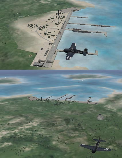
Ports are built on a hill-type object that now inherits its coloration form a terrain tile type. The hill's visibility changes with the level of detail needed to render the image -- show the hill if zoomed in or close to the port, don't show the hill if the port is viewed form a distance. This system generally works okay but not if the hill is using a terrain tile that is different form the underlying terrain. In the image below, the port hill looks like it is using the Beach tile type whereas the underlying terrain is Rock Grass.

I had set all the port's underlying terrain to Rock Grass because that is what worked with my custom NTT1001.bmp file that was used for the port hill's coloration. But someone complained that the stock NTT1001 file did not match and we now have this "compromise" that is sometimes worse then the original problem.
Since the coloration changes from one port to the next, the color must be keyed to something even if it is just port 1 gets tile type 1, port 2 get tile type 2, etc. Well, before I waste my time designing and conducting an experiment to figure out what the port hill's color is keyed to, is there anyone that knows and is willing to share that information?
MachNix