In this chicken or the egg scenario, I've got to sit down and map the general water ways off the peaks to give myself an idea of laying out feilds. So it becomes similar to sketching leaf veins in art class, just one ginormous leaf with very tiny little veins rooting off the major backbone veins. I can probably set the backbone veins to 5,000ft in the RAW file and wing the rest off that. On the real Svalbard island, the tallest peaks, and only a few, don't quite reach 5,000ft. So I can have some fun sculpting and not worry about blowing too much away. Setting the land blocks other than the mountain backbones to popup all 1,000ft will solve many shore line issues. Since on this kind of topography, it's majority cliffs and mountain side walls that slope right down into the water. Very little flat land in large areas other than in runoff basins and river mouths but, there are flat heights due to the nature of the lava and rock types and how they erode. And it's all black rock for the most part so I just elevation paint black rock from -1000 to 6000ft after I import the RAW file.
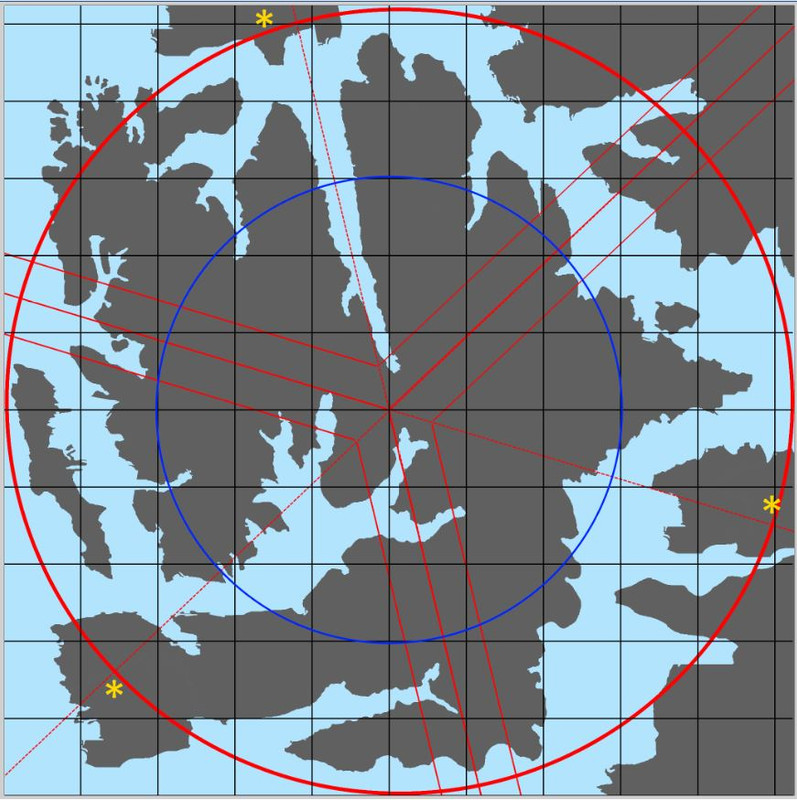
Below is my field layout dilemma which will require mapping mountain spines and runoff water ways. I'm planning two fleets per country and exposing the HQ\strat to gratuitous destruction in the red ring area. The blue ring is a 6 sector diameter which I've found with my last three terrains to be the effective combat area to keep players at each other. With two CV per country, aside form targeting the HQ and some strats, I can see salting the outer area defined by the red circle with bases for ship to shore field captures. Before I can even go there, I have to topographically profile the place. At least I have topographical profile maps of the real Svalbard island that detail everything so I can understand how to create the ridge lines that all the fjords tiny to huge are paired with. An interesting note, the center of Svalbard where several deep fjords meet like you see here, it's all flat runoff cut about 4 miles wide at each mouth gently sloping up to 100ft then inland as deep water cuts with small rivers off a glacier. I don't want to do the glaciers that cover the central inland of the east and west lobes. No one puts airfields on glaciers. I probably should make sure a task group can steam up near the ends of those central large fjords, I'll have to test what the minimum width is that a task group can turn around on it's own line in patrol mode. Don't need to get CV's stuck in there even though steaming up into one will make them sitting ducks to bombers. It may well not be possible thinking about the max range you can launch LVT. Meh, won't know until I reach that stage....