It's been 5 months since I designed the task group combat pond and I realized I couldn't remember how I setup the ranges between feilds surrounding the pond. This is in terms of the field of fire and max range for shore battery. I've been so fixated on building and painting topography I lost track of some of my technical design. Usually when I get back to installing and adjusting that aspect of the game, if I don't remember or, my notes in the blue print stage are sketchy. I muddle around until I can see what I was thinking by the setup itself.
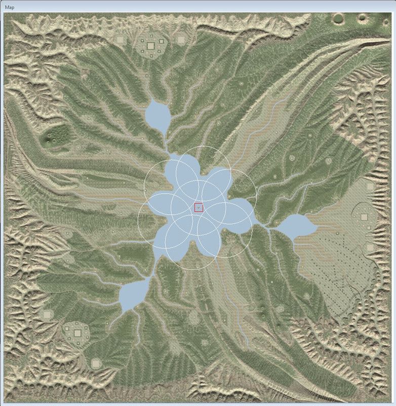
Did you know you can set down map rooms anywhere in any number and only save them, then in the circles setup for the CBM window choose map rooms as the focus and set a ring radius that the map room or other game object will be the center of that ring? That is a measuring tool intergal to the terrain editor and how you set the distances between feilds.
As you can see in the screen shot, I've set the radii for 18miles which is the max range for the 8in gun in the shore battery. The feilds themselves are 22miles from the tiny center island in the pond. And I can see my gun arc will not allow dropping rounds on the field to either side. I'll worry about the ports later, looks like they may just miss if I place a shore battery behind the port by eyeballing it from the screen shot.
Five months to create the topography, a month or so to drop in all the fields, build all the mini tank combat terrain and who knows, I still have to setup the first instance of the new supply path system along with use the river path in none AI supply mode to replace some of those rivers I manually cut in. And that means bridges....Weeeeeeeeeeeeee...
..................
That tiny island sits in the max range blind spot on purpose so you can't hide a BB in there. Those 6 rings just miss by the 3mile segment touches land buffer. Whoda thunk it....